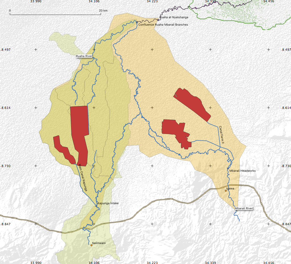
Main Features of the Usangu Rice Plain Hydrology.
Water flows from the Southern Mountain Range in the Ruaha (West) and Mbarali Rivers (East) into the Usangu Plain (Center). At Salimwani and Igawa Gauge Stations the Inflow is measured just before crossing the Great North Road. During the dry season, the complete river flow can be diverted at both Diversion Weirs (Kapunga, Mbarali). At Kapunga at least half of the flow is left in the Ruaha and flows via the informal rice fields of Mpunga Moja and the Ikwavuli Ward into the Ruaha National Park in the North. Drainage water left after crossing these informal rice fields eventually joins the drainage flow from the Kapunga Rice scheme and reaches the Confluence with the Mbarali.
Similarily the diverted water from the Mbarali River eventually reaches via the Mbarali Rice Farms the same confluence. As soon the drainage reduces to hundreds of liter per second zero-flow will be observed. Either close to the Confluence but normally the first observations are recorded just downstream of Nyaluhanga. In the North East on the map, the Ruaha flows into the Ihefu Swamp.