Mtera Catchment — JAXA GSMaP_NOW
Rainfall RATE (mm/hour) · official JAXA near-real-time product · Mtera outline from supplied GeoPackage · times in Tanzania (EAT, UTC+3)
Rainfall raster pending
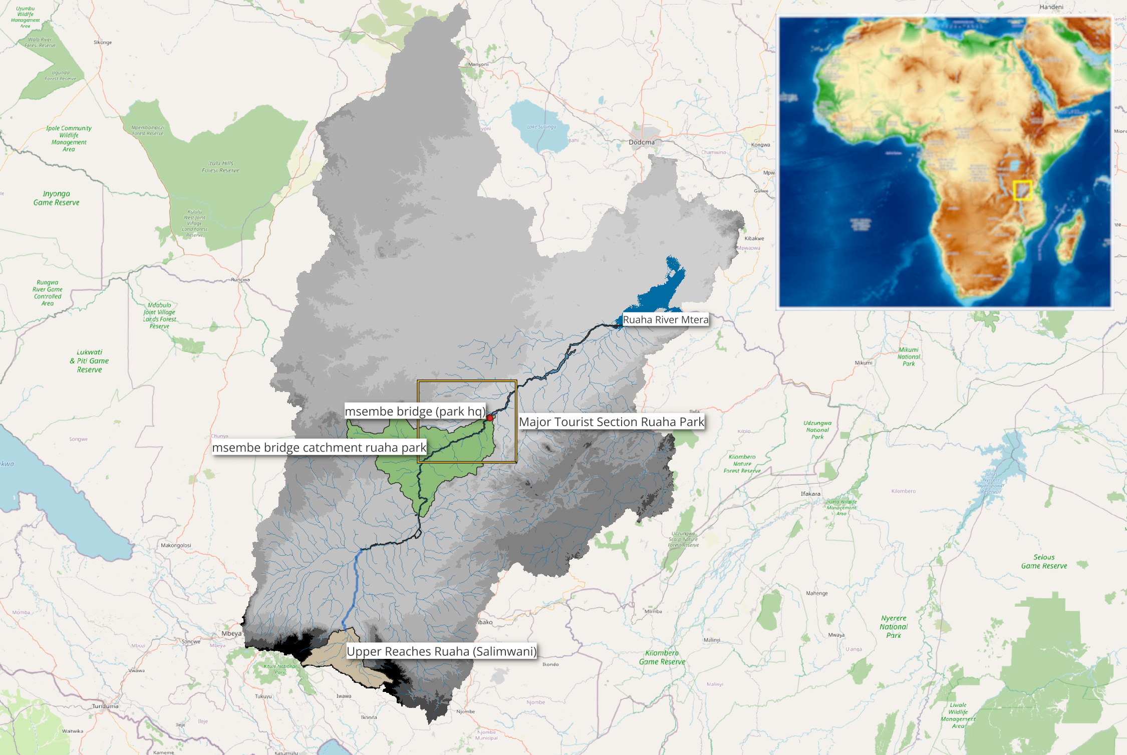 Reference inset · click to enlarge
Accumulated Mtera rainfall since ParkHQ machine ZFO
From 29 September 2026. Catchment-mean rainfall depth (mm), using a separate validated JAXA daily series. Not the Salimwani–Msembe rainfall-equivalent volume graph.
Daily accumulation not published: awaiting validated JAXA catchment data (no values invented).
Data and interpretation
When the server publishes a processed JAXA NOW file, the rainfall overlay and actual UTC/EAT observation time appear here. The map checks for updated metadata every 2 minutes.
Background: NASA GIBS Blue Marble shaded relief (terrain only, not rainfall). No Google Maps, OpenStreetMap or NASA rainfall tiles are used; the polygon follows the real coordinates.
GSMaP_NOW is an immediate rainfall diagnostic, not a rainfall forecast. Missing satellite values are not displayed as zero rainfall.
Satellite rainfall: Global Satellite Mapping of Precipitation (GSMaP) © JAXA/EORC. Basemap: NASA GIBS Blue Marble. Catchment boundary: supplied Mtera GeoPackage. Native NOW grid: approximately 0.1°; colored overlay preserves the native grid.