How To Detect Return Flow from New-NAFCO canal to Mbarali River
MENU
The newest post and image entries are on top of the page. Scroll from the bottom upwards to follow the flow status timeline of the Ruaha River per location
The Mbarali New NAFCO Main Canal has a small hydro power plant using 1 cumecs. Immediately downstream of the plant a return drain is constructed to secure return of the 1 cumecs to the Mbarali River after passing through the turbine. The practice of returning the water “borrowed” for power generation is not always honored. Remotely monitoring of the return flow is possible with low flow in the Mbarali River at the New NAFCO headworks. And it is especially during the low flow period very important to maximize drainage from the Usangu Rice Plain including the draiage from the Mbarali River. Monitoring of the return flow by the authorities is therefore an important management tool.
During low flow some 2 cumecs is diverted from the Mbarali River and the excess is passing over the weir or leaking through the sluice doors. On July 6, 2009 some few hundred liters per second are left in the Mbarali River downstream of the weir as shown on the high resolution image below.

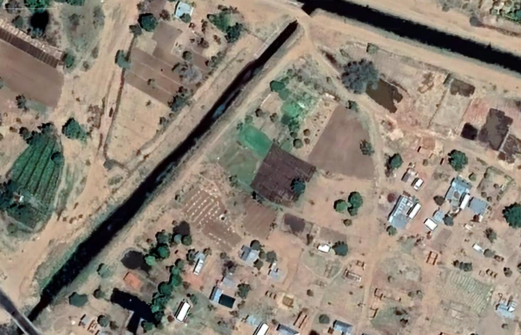
The remaining water in the Mbarali River reaches the return drain outlet some 4.6km downstream of the headworks (as the bird flies). On July 6, 2009 the returned flow in the drain seems to be maximal as the water level is close to the allowable 0,6m freeboard at the first lined section at the junction with the main canal. This is concluded from comparing the next two images of which the second is from December 26, 2021 when almost no drainage water is diverted.


The Return Flow shown on the July 6, 2009 high resolution image as it joins again the Mbarali River is also detected remotely by the Landsat 5 near infrared image as is demonstrated in the second image below.


As the return flow to Mbarali River can be distinguished with the high resolution images like the one above from July 6, 2009, especially with (near to) zero flow in the Mbarali River at the outlet. It is now a matter to search for “foot prints” of incoming return flow at the outlet in the almost dry riverbed of the upstream Mbarali River.
Using the analyses for the New NAFCO will confirm the low flow status of the Mbarali River by verifying the (near) zero flow over the weir. The exposure of the riverbed sediments between the outlet of the return drain and the New NAFCO Headworks will also confirm the low flow to zero flow status in the Mbarali.
The natural color and near infrared Sentinel 2 images with 10m resolution are with some manipulation suitable to show the gullies with flowing water from the outlet.
Panchromatic images with 15m resolution can also indicate deeper pools of water as is demonstrated for the return flow captured on August 23, 2011. The Panchromatic image from Landsat 7 is taken a few days later (September 6, 2011) and indicates the deeper pools of water in the return flow as it flows into the Mbarali River.

