Flow at Park HQ returned on December 3, 2024
MENU
The newest post and image entries are on top of the page. Scroll from the bottom upwards to follow the flow status timeline of the Ruaha River per location
Ruaha River Flow Monitor Tool (Remote Sensing) Flow Status Today: 15 Days of Zero Flow at Park HQ in 2024
Flow Returned between December 1, 2024 and December 6, 2024
Last Updated 7 months agoBased on Landsat imagery on December 1 and December 6, 2024 water returned at the Ruaha Park HQ on approximately December 3, 2024

Flow Ruaha may have returned to be confirmed
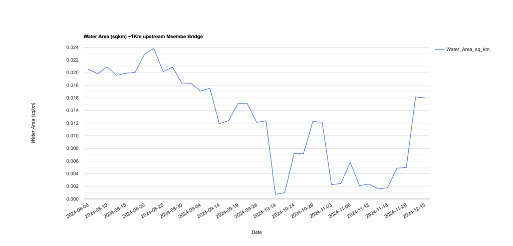
NDWI based Water Area values show increase on or before November 28 2024. With the confirmation of increased flow on December 3, 2024 the zero flow period will be corrected.
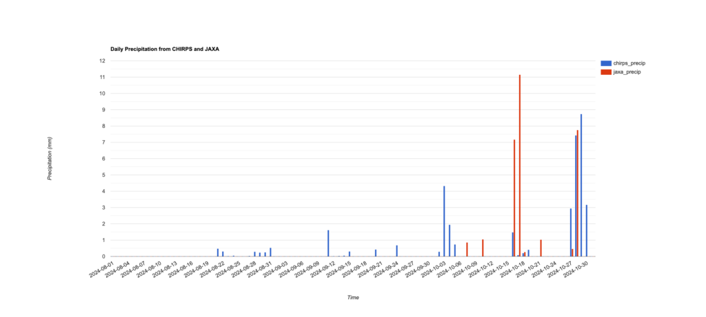
Recent Rains could be related to the return of the flow. The precipitation in the upper reaches of the ruaha and mbarali rivers is expressed in mm/day using CHIRPS satellite data. In the chart also GSMap realtime data are included for comparison. The gsMap (JAXA) data are for a point in the upper reaches of the Ruaha. The data end in October.
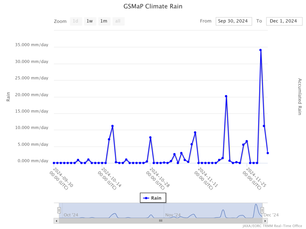
More recent data from JAXA realtime precipitation suggest more rains in November which may have reached the Ruaha River at Msembe (Park HQ) around the end of November. Sustained flow early December will confirm return of flow in the Ruaha Park.
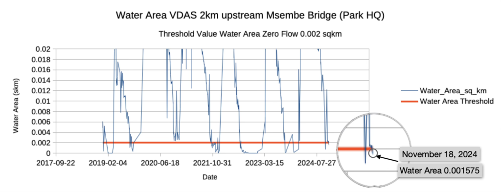
Zero Flow Announced on November 18, 2024
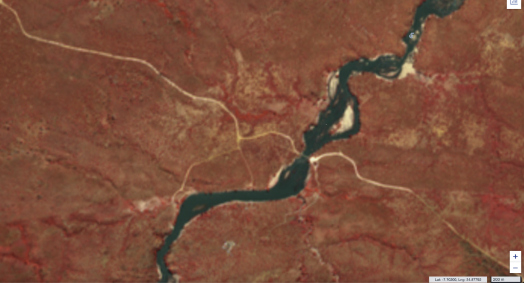
Using the Google Earth Engine developed threshold level for the water area at the VDAS 2km upstream of the Msembe Bridge, the start of the zero flow period is estimated between November 13 and November 18, 2024 as the Water Area within the Area of Interest (see box on image below) dropped under the critical value of 0.002 sqkm. The Msembe Bridge (ParkHQ) is in the upper left and the AoI in the upper left for which the critical ‘water area’ is defined. The graph below shows the water areas in the previous years with 2020 as reference year without occurrence of zero flow. Click on Image to enlarge.

Weeks to Zero Flow at Park HQ October 14, 2024
Comparison of 3m pixels planet.com image with the October 14, 2024 image suggests some one to two weeks from zero flow as is illustrated in image gallery below.
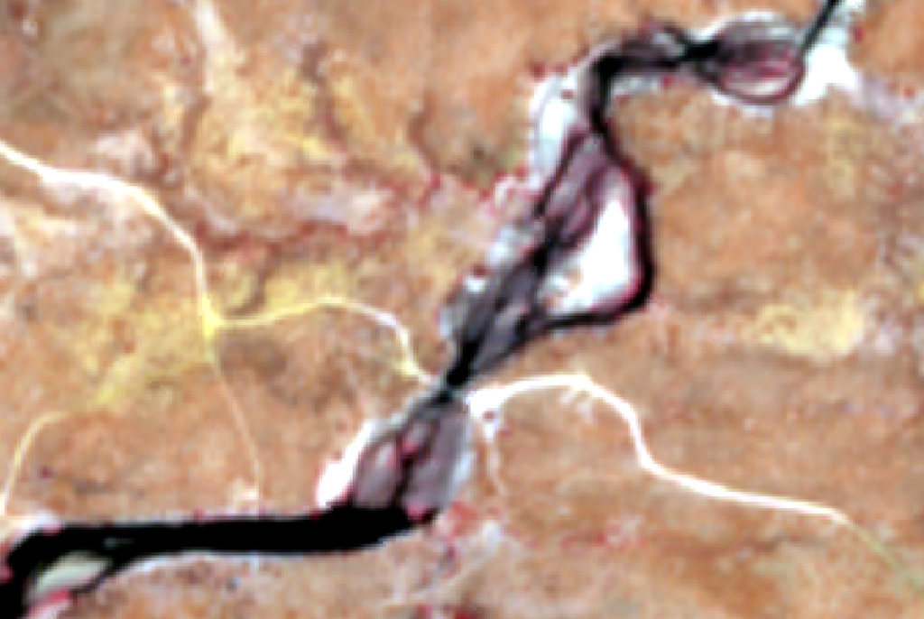

Compare flow channel reduction NDWI based visualization
The combination of images providing improved visualization of the flow reduction is illustrated in the sentinel2 image gallery below.
The NDWI image mask (water and no-water) with 20m resolution is combined with the 10m false color (Band 4, 3, 2) composite and with the resampled 5m false color composite on July 11, 2024. The reduction of the flow channels on July 11 as compared to June 6, 2024 below, is clearly visible and will be helpful to more accurately determine zero-flow. (Click to enlarge images)
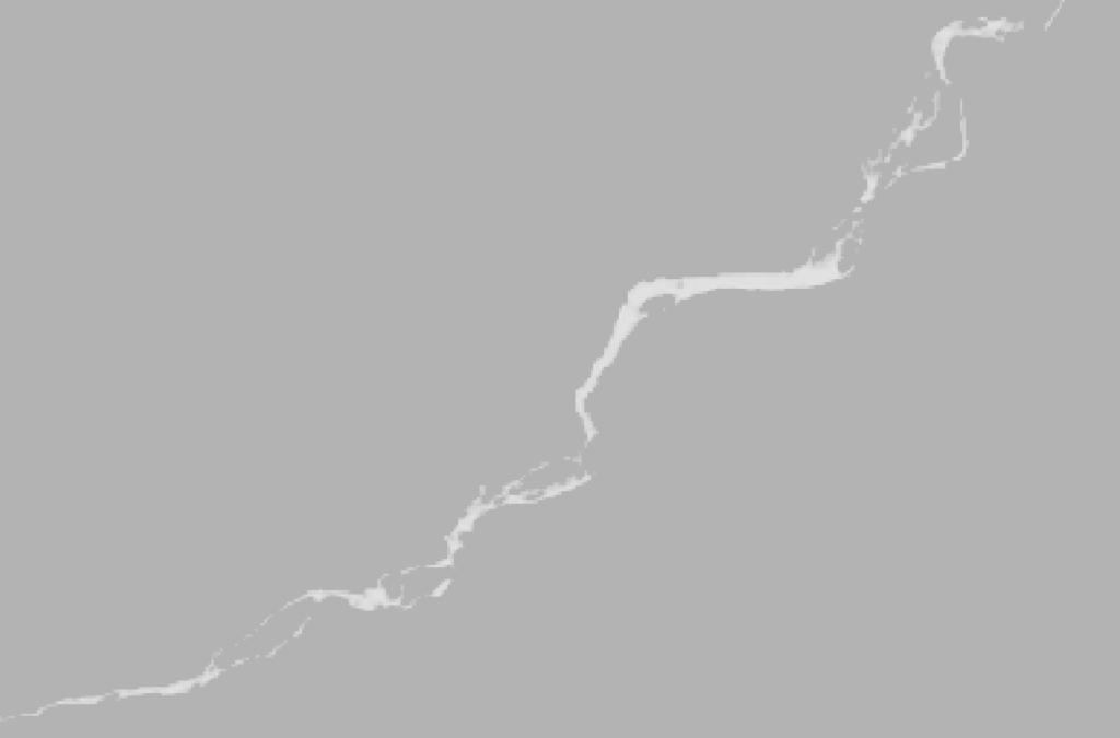


Without the NDWI mask the comparison of the flow status at Msembe (Park HQ) of the false color images of June 6 (left) and July 11, 2024 (right) is captured in the gallery below. (Click image to enlarge)


Improved visualization Flow Channels Msembe
The Ruaha River seems swollen at the Msembe bridge to the Ruaha Park HQ (where the white line crosses the river) . Combination of the 20m resolution NDWI image of sentinel2 with the false color image (10m) below on June 6, shows that the actual water channels are holding less water while the water channels are difficult to distinct from wet sediment and wet rock with shallow ponds and vegetation. (click to enlarge image)

Status flow at Ruaha Park HQ on June 6, 2024. False color 10m pixel resolution at Msembe Bridge. (click to enlarge)
