Early Irrigation Kapunga – Zero Flow Park HQ
MENU
The newest post and image entries are on top of the page. Scroll from the bottom upwards to follow the flow status timeline of the Ruaha River per location
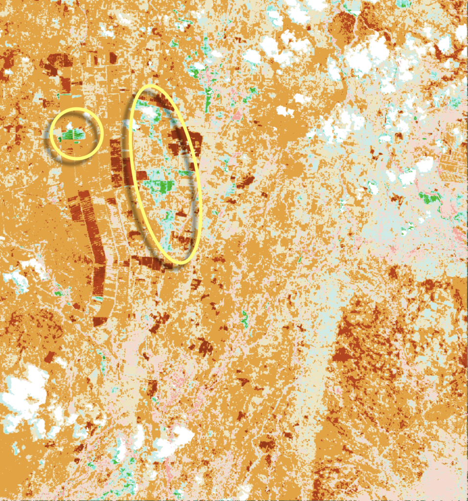
Expansion pre-irrigation limited by low availability of water in Ruaha
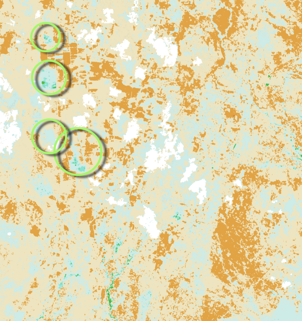
The very limited flow remaining in the Ruaha hampers the expansion of pre-irrigation in Kapunga and Mbarali. The pre-irrigation on November 27, 2023 in Kapunga Scheme, is indicated by green circles. The clouds in the NBR image are masked (white) to distinguish between clouds and pre-irrigation and swamps (blue to green)
Slight increase pre-irrigation with first nurseries
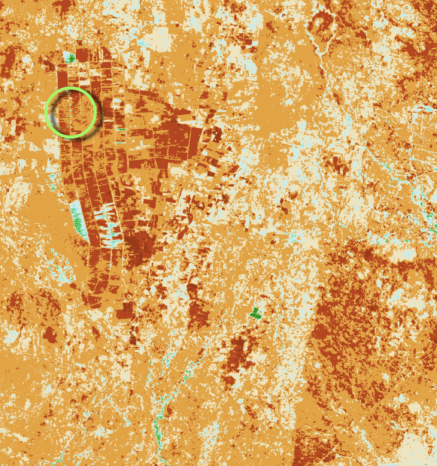
In Kapunga the first rice nurseries can be detected on November 12, 2023 (Click on image). Some of these farms were already pre-irrigated since mid-August. Although the remaining flow in the Ruaha is expected to further decline as the inundated fields are expanding.
Water in Kapunga scarce with few farms pre-irrigate
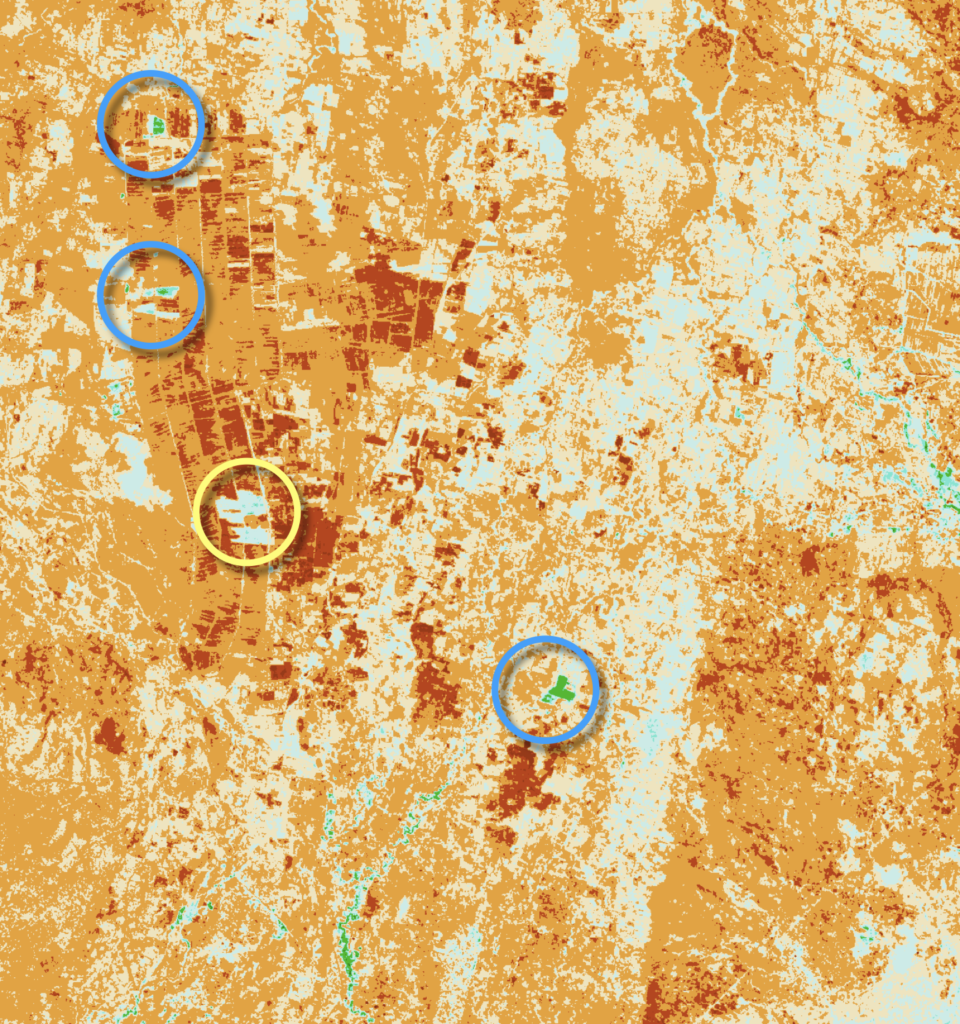
Eleven days into the zero flow period at Ruaha Park HQ water seems to become limited in Kapunga Ifushiro Area with no significant Early pre-irrigation. Image is compilation of November 2, 2023 (clouded) and October 28, 2023.
Stable Alert3 Irrigation Activity Kapunga
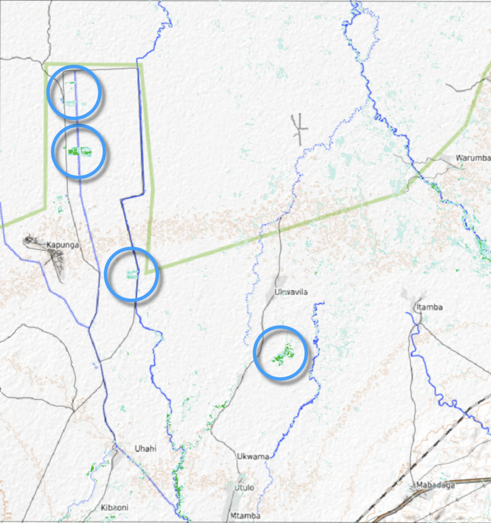
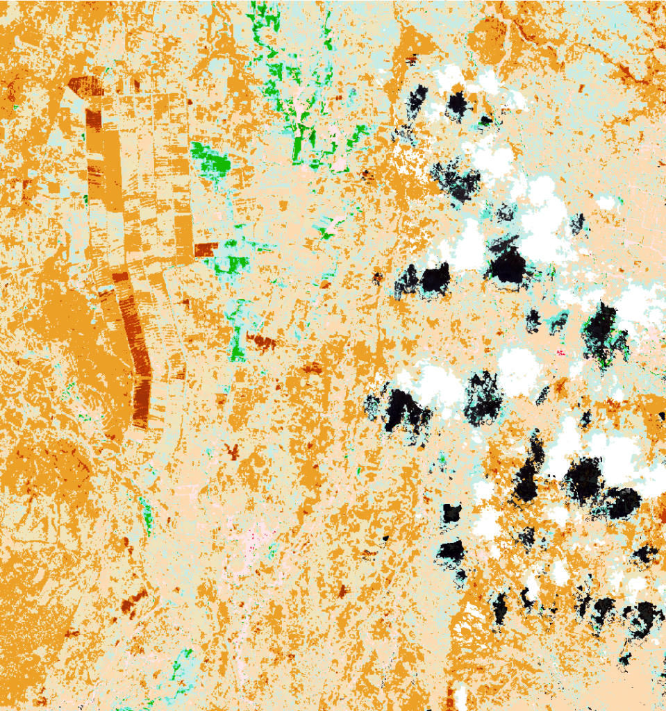
Rice Pre-Irrigation activities did not increase significantly during the Alert 3 period (September 28, 2023). Compare irrigated areas in Kapunga and Ifushiro within blue circles on October 13, 2023 to September 28, 2023 images below .
Recoverable spill and early (pre-) irrigation Alert 3
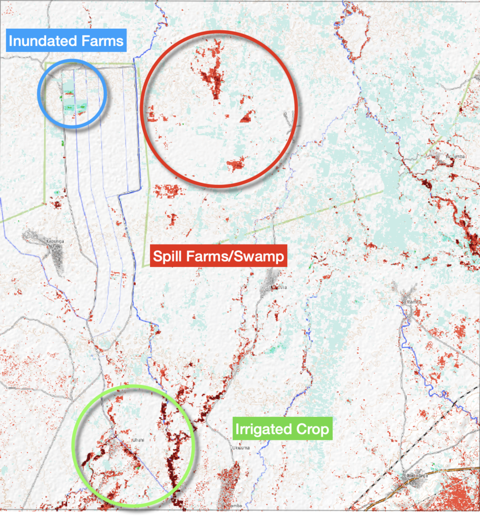
With the announcement of Alert 3, non-essential abstraction and related spill is observed on September 28, 2023. Compare the areas of pre-irrigation of rice at Alert 3 with the status of abstraction and spill on September 8, 2023

Recoverable water for drainage to Park, 2 weeks after Alert Two
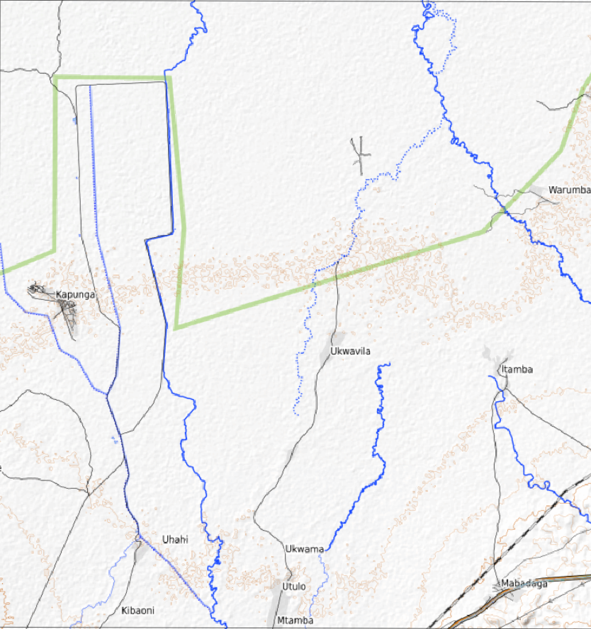
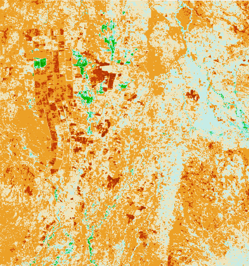
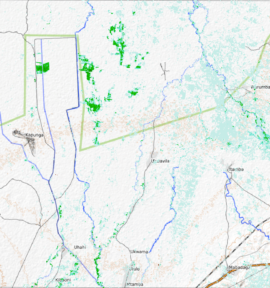
The tracking of early irrigation and spill in the Kapunga area is detailed with the images of September 8, 2023. Some farms in the Kapunga rice scheme have their fields already inundated since August 14, 2023. (see image). Most of the watered vegetation seems to be swamp vegetation associated with spill of abstracted water in lower areas from leaking irrigation canals (Ifushiro area).
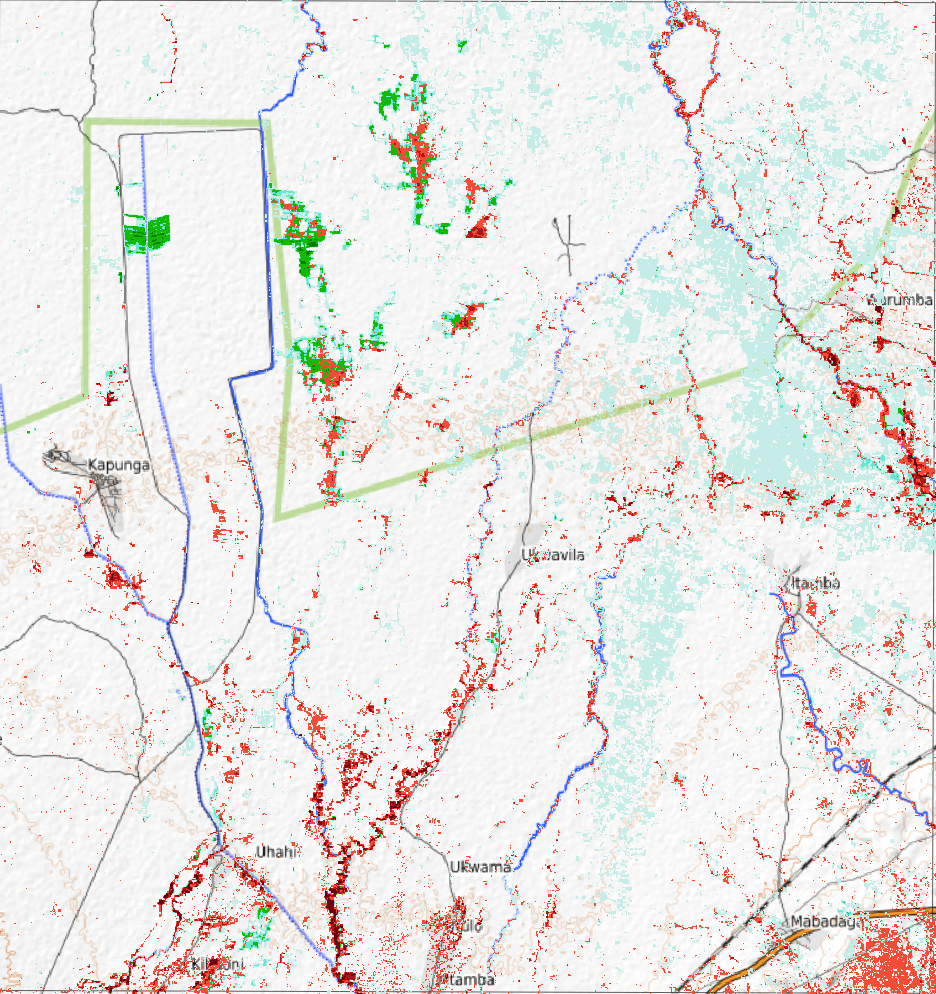
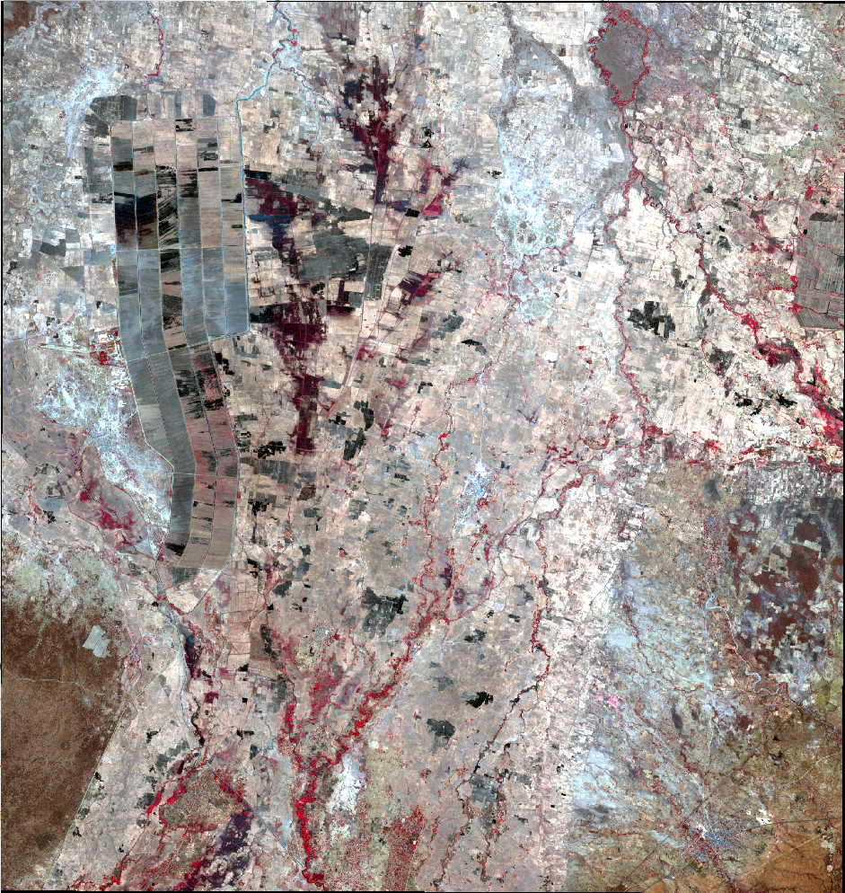
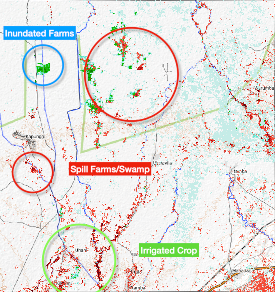
Kapunga – Ifushiro flooded fields days before Alert One
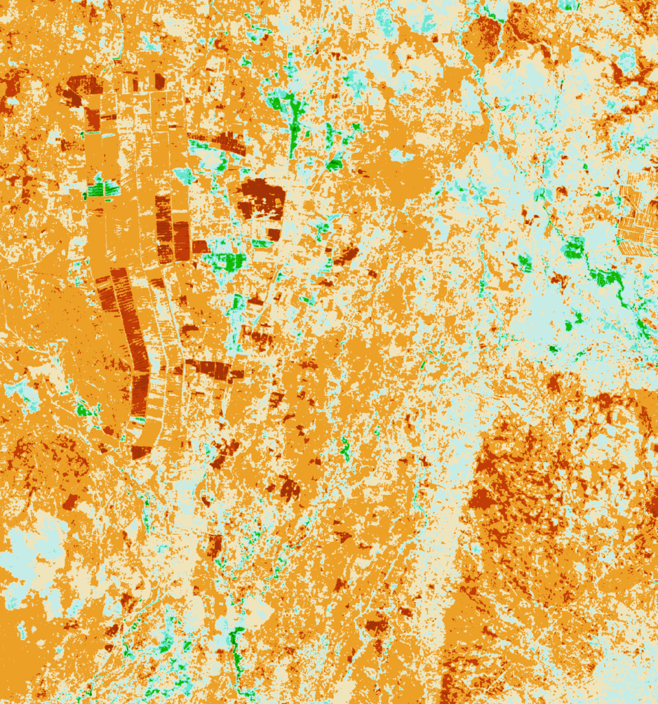
Compare Irrigation and Spill end of June and July
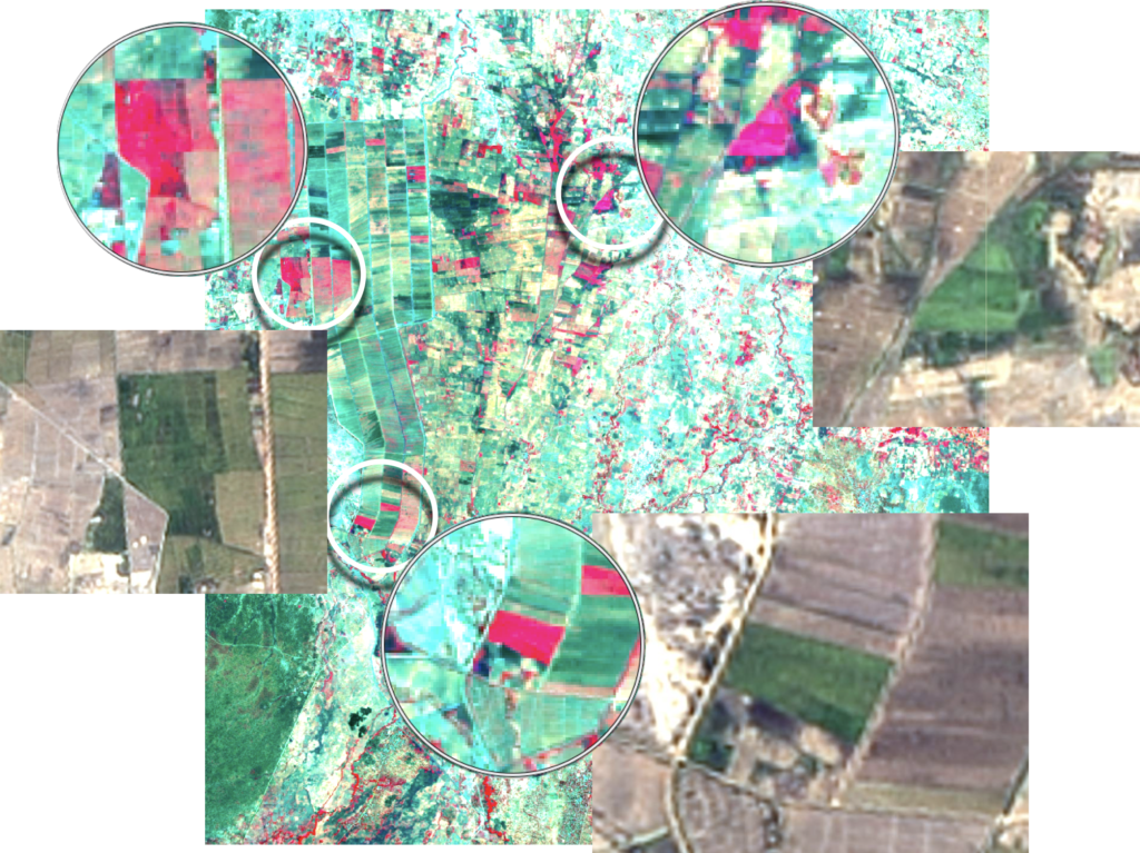
The irrigation in the Kapunga commercial scheme is completed and no signs of out-of-season irrigation on July 20, 2023. In Ifushiro some areas are monitored for out-of-season irrigation or spill. Compare the masked NBR image of June 27 (post below) and detail in RGB of an irrigated out-of-season crop or swamp/spill area (400ha)


Please take notice of Clouds and Shades in Mbarali (July 20, 2023)
The masked image above suggests major areas in the Mbarali Sub-catchment with either pre-irrigation or irrigated crop/ spill. As the RGB overlay on the NBR-SAVI masked image demonstrates, are the blue and green areas in the Mbarali River sub-catchment suggesting irrigation or leakages (see video clip) actually clouds and their shades on the ground.
Irrigated crop Kapunga June 27, 2023
Pre-Irrigation and Spill in pools and depressions June 27, 2023
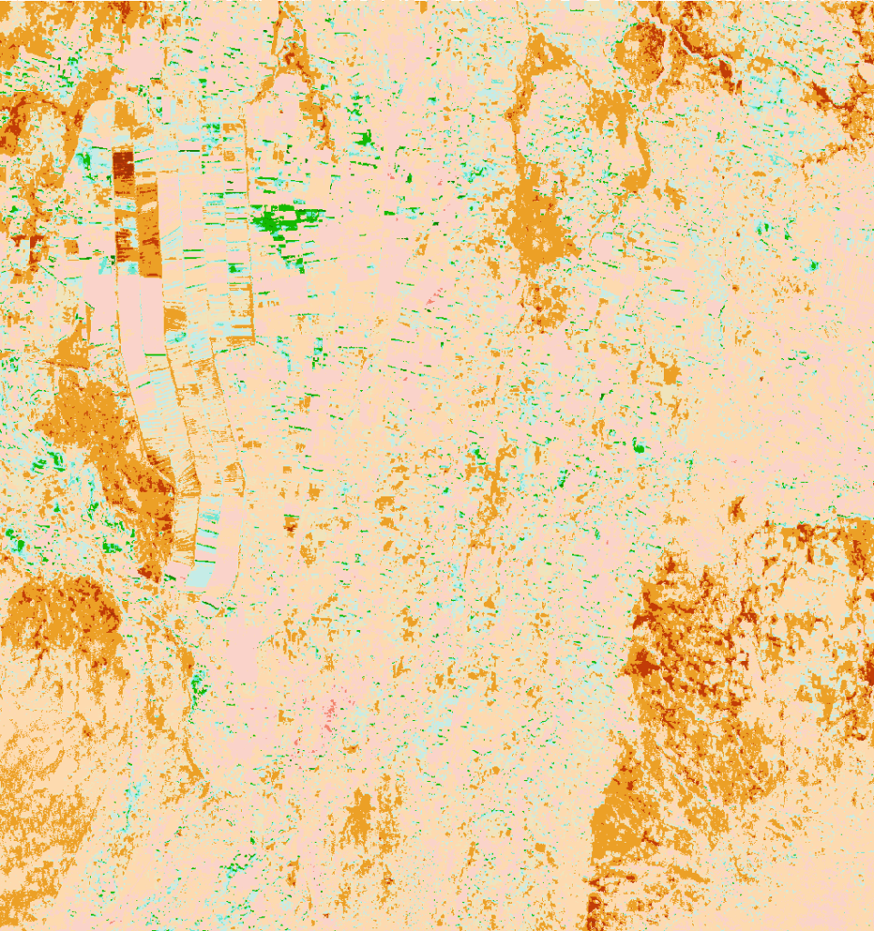
One of the procedures to detect pre-irrigation, spill and pools without vegetation from NBR composite image (Landsat 8 on June 27, 2023). The vegetation is deducted (masked) from NBR as shown in the image sequence below.


Out-of-season Pre-Irrigation or Spill June 15, 2023
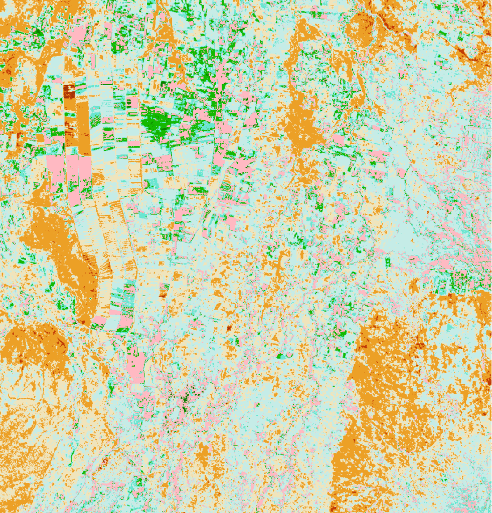
Semi-automated tracing of (Pre-) Irrigation (see Video Clip) for the Usangu Rice Plain on June 15, 2023 is demonstrated in the image below. Green – Blue colors are potential pre-irrigation locations of spill through “lost” drainage water to the Ruaha National Park in depressions and pools.
Manual selection pre-irrigation May 31, 2023
The “Natural Color” image of the Kapunga – Ifushiro Area on May 31, 2023 is monitored for Out-Of-Season, early irrigation of rice. Dark fields which could indicate inundated rice fields without crop (pre-irrigation of rice) are analysed using different wavelength band combinations.
The yellow arrows are most probably fields with pre-irrigation or leaking/unattended canals. The white arrow is spill due to depressions/low lying fields. The white circled area is dry possibly burned or rotten crop remains.
