MENU
The newest post and image entries are on top of the page. Scroll from the bottom upwards to follow the flow status timeline of the Ruaha River per location
Last Updated 4 days ago
Nyaluhanga early warning: machine-confirmed decline in river channel
The Nyaluhanga A3 machine monitor confirms a decline in mapped channel-water occupancy between 2 October and 11 November 2026. The result is based on eight paired AOI6/AOI7 probe rows using the calibrated FC joint-pop Random Forest method on Sentinel-2 B8/B4/B3 data processed on a derived 5 m grid. All eight probe pairs passed the required local clear-coverage check on both endpoint dates.
The quality-controlled WATER support declined from 702.99 m² on 2 October to 525.87 m² on 11 November: a reduction of 177.12 m², or 25.2%. The proportion of classified probe area occupied by WATER fell by 22.12 percentage points, while the number of probe pairs in which both sides were classified as WATER fell from four to two.
| Machine indicator | 2 Oct 2026 | 11 Nov 2026 | Recorded change |
|---|---|---|---|
| QC probe WATER support | 702.99 m² | 525.87 m² | −177.12 m² (−25.2%) |
| QC WATER fraction | 87.80% | 65.68% | −22.12 percentage points |
| Strict BOTH-WATER probe pairs | 4 of 8 | 2 of 8 | −2 pairs (−50%) |
| Overall machine result | 2 Oct–11 Nov comparison | DECLINE_CONFIRMED | |
| Latest clear transition | 6 Nov–11 Nov | DECLINE_CONFIRMED | |
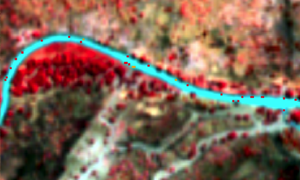
The accompanying image provides spatial corroboration. The overlaid classified footprints show that the earlier channel-water envelope extends beyond the later footprint along multiple channel margins. This visible contraction is consistent with the quantitative 2×8 probe result.
The complete series was not continuously declining: short-lived increases were detected during 22–24 October and 3–6 November. Nevertheless, both the full 2 October–11 November comparison and the latest eligible transition independently indicate decline. The resulting seasonal status is therefore machine-confirmed declining channel-water occupancy at Nyaluhanga.
Interpretation boundary: this is an early-warning indicator of declining flow conditions at the A3 river section. It measures mapped channel occupancy rather than discharge and does not independently declare ZFO, ROF or publication authority. The calibrated classifier remains recorded as CANDIDATE_NOT_FROZEN, with final interpretation and publication retained as a human decision.
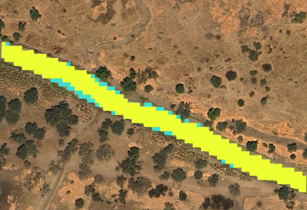
September 12, 2026 Alert 3 Confirmed
Nyaluhanga reached an advanced low-flow transition in mid-September 2026.
On 7 September, both fixed branch-inlet indicators (A16 and A17) were still WATER-classified. A16 changed to NO-WATER by 12 September while A17 remained WATER, marking the presently identified candidate ALERT 3 transition on 12 September. A17 subsequently changed to NO-WATER by 17 September, providing dry-side confirmation that the branch-waterline transition had progressed.
Over 14–17 September, the whole-A3 p50 diagnostic WATER area also declined from approximately 29,346 m² to 15,302 m², supporting the observed retreat.
ALERT 3 at Nyaluhanga refers to the critical low-flow/disconnection transition of the monitored branch; it does not mean that the main Great Ruaha River is completely dry. The present date is supported by the 2026 machine observations and independent physical validation, but the transferred classifier remains diagnostic while historical A3 validation is completed.
| Date | AOI6 / A16 | A16 p50 WATER probability | AOI7 / A17 | A17 p50 WATER probability |
|---|---|---|---|---|
| 7 Sep | WATER | 0.5125 | WATER | 0.6868 |
| 12 Sep | NO-WATER | 0.4960 | WATER | 0.7504 |
| 14 Sep | NO-WATER | 0.3616 | WATER | 0.6985 |
| 17 Sep | NO-WATER | 0.2746 | NO-WATER | 0.4979 |
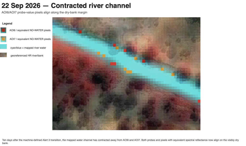
On September 12, 2026 Alert 3 Imminent
ALERT 3 — Critical transition reached / confirmation pending.
Sentinel-2 observations indicate that by 12 September 2026 the water/no-water boundary had reached the critical ALERT 3 branch-inlet location. Joint-population analysis classifies A16 as NO-WATER while A17 remains WATER, consistent with the shoreline lying approximately across the critical detector pair. The next suitable satellite observation will determine whether the waterline has moved beyond the critical inlet and confirm ALERT 3.
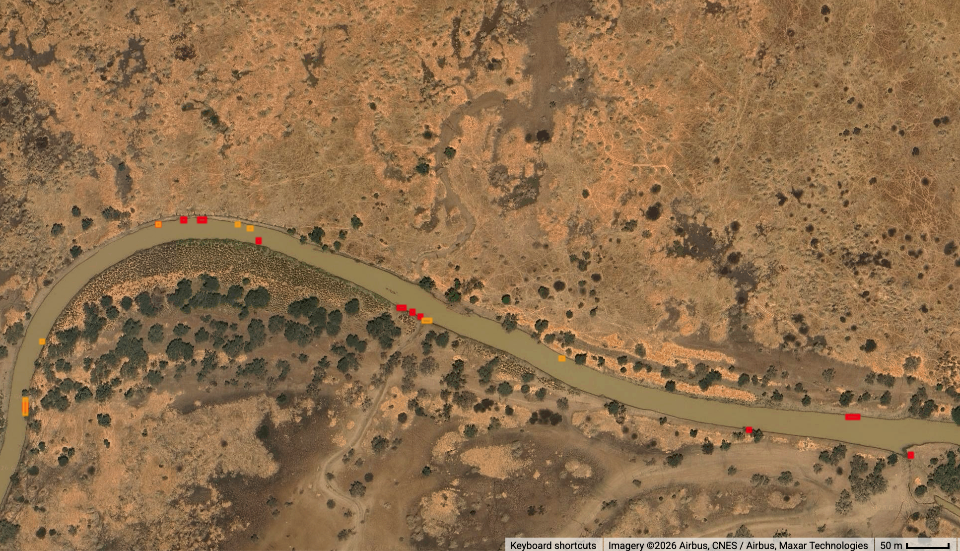
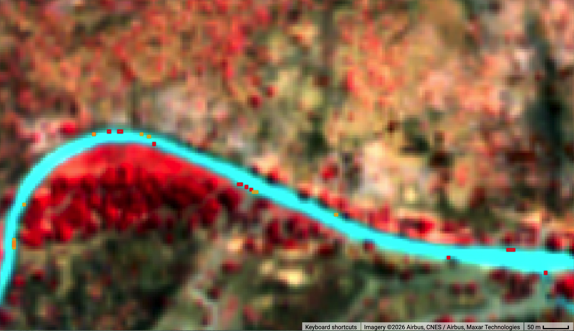
Check Non-critical Waterline Current Flow Nyaluhanga August 28, 2026
The high resolution sub critical flow some 6 days after Alert 3 in 2023, has not yet been reached on August 28, 2026
Usangu Rice Drainage Flow on August 18, 2026
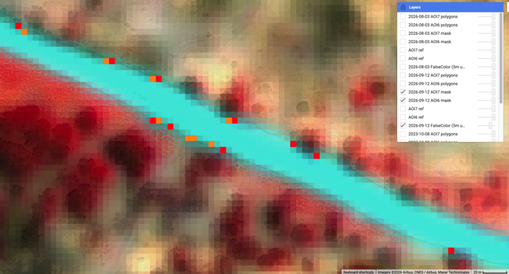
The similar pixel based waterline check suggests the flow at the Nyaluhangu river section virtual flow station, is not yet critical (Alert3).
For high resolution of the comparable river flow visit here. The current flow will be monitored and latest update is shown in images below.

The waterline related pixels indicate inside or outside the ruver channel indicate the reaching of Alert3 which according to unauthorative flow data is in the range of 8cumecs
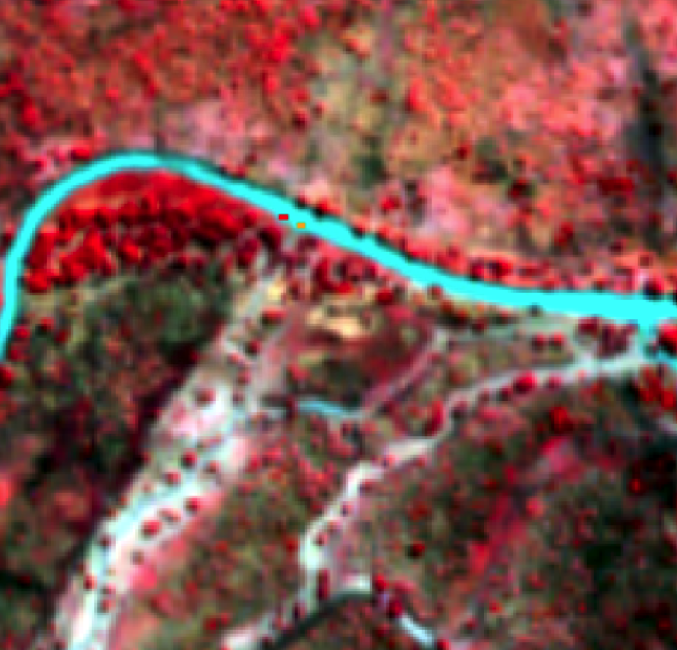
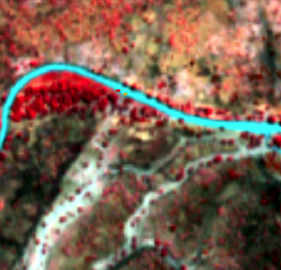
A closer look at the water line (reference pixels) in August 18, 2026 shows the critical water line (Alert3) has not yet been reached by retreating water channel.